


VTD precinct 12, Union County, South Dakota
About
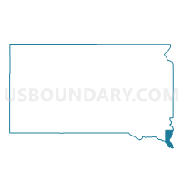
Outline

Summary
| Unique Area Identifier | 667837 |
| Name | VTD precinct 12 |
| County | Union County |
| State | South Dakota |
| Area (square miles) | 8.23 |
| Land Area (square miles) | 7.19 |
| Water Area (square miles) | 1.04 |
| % of Land Area | 87.34 |
| % of Water Area | 12.66 |
| Latitude of the Internal Point | 42.52846100 |
| Longtitude of the Internal Point | -96.52528730 |
Maps


Graphs
Select a template below for downloading or customizing gragh for VTD precinct 12, Union County, South Dakota


Neighbors
Neighoring Voting District (by Name) Neighboring Voting District on the Map
- Covington Island Precinct, Dakota County, NE
- SIOUX CITY PCT 5, Woodbury County, IA
- St. John's Precinct, Dakota County, NE
- VTD - Dakota Dunes, Union County, SD
- VTD precinct 11, Union County, SD
- VTD-precinct 10, Union County, SD
- VTD-precinct 9, Union County, SD
Top 10 Neighboring County Subdivision (by Population) Neighboring County Subdivision on the Map
- Sioux City city, Woodbury County, IA (82,678)
- Big Sioux township, Union County, SD (3,259)
- North Sioux City city, Union County, SD (2,530)
- Covington precinct, Dakota County, NE (2,283)
- Jefferson township, Union County, SD (943)
- St. Johns precinct, Dakota County, NE (754)
Top 10 Neighboring Place (by Population) Neighboring Place on the Map
Top 10 Neighboring Unified School District (by Population) Neighboring Unified School District on the Map
- Sioux City Community School District, IA (83,145)
- South Sioux City Community Schools, NE (17,700)
- Dakota Valley School District 61-8, SD (6,278)
- Elk Point-Jefferson School District 61-7, SD (3,907)
- Homer Community Schools, NE (1,661)
Top 10 Neighboring State Legislative District Lower Chamber (by Population) Neighboring State Legislative District Lower Chamber on the Map
Top 10 Neighboring State Legislative District Upper Chamber (by Population) Neighboring State Legislative District Upper Chamber on the Map
- State Senate District 1, IA (57,231)
- State Senate District 17, NE (36,601)
- State Senate District 16, SD (23,892)
Top 10 Neighboring 111th Congressional District (by Population) Neighboring 111th Congressional District on the Map
- Congressional District (at Large), SD (814,180)
- Congressional District 1, NE (626,092)
- Congressional District 5, IA (577,453)
Top 10 Neighboring Census Tract (by Population) Neighboring Census Tract on the Map
- Census Tract 203, Union County, SD (7,578)
- Census Tract 103, Dakota County, NE (4,381)
- Census Tract 104, Dakota County, NE (3,433)
- Census Tract 6, Woodbury County, IA (2,712)